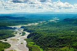
Satellite remote sensing for monitoring species diversity
Published in the journal «Remote Sensing in Ecology and Conservation», the research examines the real potential of SRS, as well as the pitfalls that need to be avoided to achieve its full potential. The study takes the assessment of diversity in plant communities as a case study. Showing the difficulties to achieve high results by relying only on field data, the paper discusses the advantages of SRS methods. In contrast to field-based methods, SRS allows for the complete spatial coverage of the Earth’s surface under study over a short period of time, the paper found. The paper’s lead author was EU BON’s task leader Dr. D. Rocchini from the Fondazione Edmund Bach, one of the project consortium partners. Going beyond traditional methods Using traditional methods as laid down by ecologist R. H. Whittaker in 1972, the assessment of biodiversity at local and regional scales relies on both local diversity (called ‘alpha-diversity’) and species turnover (called ‘beta-diversity’). Only with a combination of these two measures can there be an accurate estimate of the biodiversity of a certain area. While the assessment of alpha-diversity is relatively straightforward, calculation of beta-diversity could prove to be quite challenging. This is where increased collaboration between the remote sensing and biodiversity communities is needed in order to properly address future challenges and developments. Species monitoring in relatively large areas has always proven to be a more difficult task for ecologists, mainly due to the intrinsic difficulty in evaluating the completeness of the resulting species’ lists and in quantifying sampling effort. Inventorying species over a large region is complicated by the fact that it is very difficult for field biologists to inspect every individual organism in the region while accounting for changes in species composition over time. The new research has shown the high potential of SRS in biodiversity studies while also identifying the challenges underpinning the development of this interdisciplinary field of research. The researchers emphasise that in a period of major environmental change, SRS represents a powerful opportunity for ecologists to gain critical knowledge about the drivers of the spatial and temporal distribution of biodiversity. Challenges to overcome However, the research team also emphasises the possible challenges to be overcome when using SRS to map biodiversity hotspots. One of the big issues raised in the study includes the need for increasingly complex data analyses in order to effectively quantify and monitor global biodiversity via SRS. To achieve this, there would need to be a completely new orientation of Big Data analysis using Linked Open Data (LOD). Another issue raised was the need to ensure the correct spatial resolution of imaging for various types of environment, from tropical to temperate in order to gain the most accurate biodiversity data. Overall, the study concluded that further sensitivity studies on environmental parameters derived from remote sensing for biodiversity mapping need to be undertaken to understand the pitfalls and impacts of different data collection processes and models. The EU BON project will run until May 2017 and is focused on developing a truly harmonised and integrated European biodiversity networking using on-ground and remote sensing biodiversity data from a plethora of various schemes and information facilities. For more information please see: project website
Countries
Germany

