Mapping Mediterranean deep-sea habitats
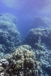
The aims of the EU funded 'Geo-acoustic mapping of benthic habitat distribution project' (GEO-HABIT) project were two-fold. They were to assess present-day natural resources and to characterise ancient conditions of deep-sea ecosystems. An interdisciplinary approach based on marine geology, seabed ecology and oceanography used geo-statistical analysis to study cold-water coral (CWC) communities. These communities are biodiversity hotspots in the deep sea. Researchers also investigated CWC mounds, carbonate formations that can provide valuable information on the climate and environmental conditions from the ancient past. Project partners wished to determine the main physical factors responsible for the development, maintenance and decline of CWC mounds in the Mediterranean Sea. They also investigated how detailed predictions of the occurrence of CWC communities can be made over large areas. Research was conducted in the eastern Alboran Sea, which lies between Spain and North Africa, to acquire high-resolution geophysical data on CWC mounds. Scientists also studied their seafloor morphology, sedimentology, water column and biology. A study of the newly mapped Cabliers Mound showed that it had a uniquely high level of biodiversity for the region. The Mound was sampled using 4 gravity cores from 5 to 11 m long, which revealed that the Cabliers Mound is different to others in the region. The data acquired will help give a better understanding of the evolution of the Alboran Giant CWC Mounds. In addition, a short documentary was produced that described the main sea-going tasks used to map the CWC mound habitats. Different predictive habitat distribution models were tested to statistically predict the distribution of three CWC species in the Cap de Creus Canyon off the north-east coast of Spain. The models enabled a better understanding of the spatial distribution of habitats at the bottom of the Mediterranean, highlighting the relationship between a species and its environment. Despite the differences between the three models, a common ecological pattern in coral distribution was identified. The outcomes of the three models were then combined to provide a better prediction for the three CWC species. The work of GEO-HABIT will enable the accurate statistical prediction of the distribution of sensitive deep-sea ecosystems. This will help to create an efficient and cost-effective science-based method of mapping that will enable stakeholders to manage natural resources more effectively.
Keywords
Mediterranean, deep-sea, geo-acoustic mapping, benthic habitat, habitat distribution