

Environmental Observations for informing citizens and supporting policymaking through innovative applications
Environmental observations (EO) are essential for food security and sustainable agriculture, disaster risk reduction, ecosystem monitoring, energy and mineral resources management, infrastructure and transport, and many other fields. EO data is already being used, delivering a diverse range of products and information, which feed numerous applications and services in support of these areas, the European Commission’s Green Deal and the climate transition. However, its potential remains largely underexploited.
Combining EO data for improved monitoring
With climate change, biodiversity decline and other environmental problems increasingly concerning our citizens and requiring policymakers to act in a timely manner, accurate information about the state of our planet is more important than ever. Combining data from satellite, airborne, ground-based and marine sensors as well as data collected by citizens, provides a wealth of information on the state of the land, oceans, atmosphere and biosphere. Indeed, the various data sources are complementary to each other as they cover different time scales, geographical scales and resolution, amongst other aspects. In situ data is also required for calibration and validation of satellite data. Moreover, due to the current pandemic, the importance of releasing information and data quickly at regional and global level has greatly increased. The EO community demonstrated its capability in this domain by launching several initiatives, such as the EU space programme’s dedicated webpage(opens in new window) on COVID-19 and the information dashboard ‘Rapid Action on coronavirus and EO’(opens in new window) created by Copernicus and the ESA.
The EuroGEO initiative
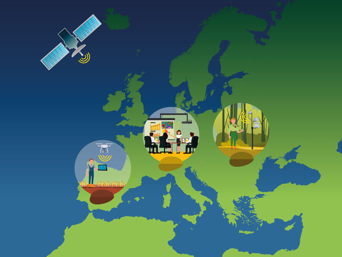
The European Union has been providing constant financial support through its successive Framework Programmes for Research and Innovation to strengthen EO. In order to maximise the impact of EU investment in EO and the use of the knowledge gained through vast programmes such as the Copernicus Programme(opens in new window), the EuroGEO(opens in new window) initiative was launched in October 2017 during the annual GEO plenary meeting. EuroGEO aims to ensure Europe’s leading role in Earth Observation and to coordinate the European contribution to the Group on Earth Observations(opens in new window), as well as addressing end user and citizen needs, transforming EO into reliable and usable information. One of the main challenges addressed by EuroGEO is to shift from a data-centric to a user-driven approach – in other words guaranteeing that the data is utilised in the most effective way. From a farmer in the field, to the forest ranger, to policymakers, researchers engaged in environmental analysis, and finally both citizens and the private sector, all of society should be able to acquire access to this invaluable treasure trove of data.
Just a taste of what’s on offer for EO
This CORDIS Results Pack introduces you to nine EU-funded projects that have been contributing to the efforts to upscale Europe’s EO capacities and to develop solutions meeting specific users’ needs. They are also actively helping to fully realise the EuroGEO initiative. The NextGEOSS project has developed a European Data Hub and Platform, providing access to EO data, with a focus on European data, often delivered by national programmes or European research projects. Using a suite of platform services and Cloud resources that are seamlessly connected, the project provides an integrated system for supporting a rich variety of applications, which contribute to the UN’s Sustainable Development Goals (SDG). The projects GROW, Ground Truth 2.0, LANDSENSE and SCENT encouraged citizens to become actively involved in the collection and use of EO data for the purpose of monitoring, for instance, soil moisture, floods, droughts, human-wildlife conflicts and land-use changes, whilst ECOPOTENTIAL used EO data to understand and monitor ecosystem changes in protected areas. Meanwhile some projects have had a specific geographical focus. The AtlantOS project strengthened and integrated EO capacities across the Atlantic, while GEO-CRADLE developed a network of stakeholders, a regional data hub and a roadmap for developing EO capacity in the interconnected regions of North Africa, the Mediterranean and the Balkans. Finally, this Pack provides a short introduction to the 4-year e-shape project that began in May 2019, will continue until April 2023 and is a truly crucial project for establishing EuroGEO and creating benefits from it. E-shape currently brings together 55 partners with the goal of delivering a comprehensive suite of EO services through the implementation of 27 pilots spanning seven thematic areas aligned with the SDGs. Furthermore, the project fosters entrepreneurship and supports the sustainable development of scalable services.