

Low-cost drones fly to the rescue of the world’s forests
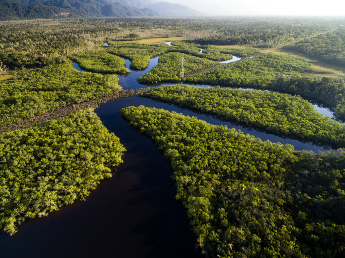
Almost 1.6 billion people – more than a quarter of the global population – rely on forests for their livelihood. Of this number, it’s said that around 60 million indigenous people are almost entirely dependent on forests to survive. Forests not only help these people to subsist, they also provide a number of essential services. They protect the soil, regulate water and support biodiversity. Equally important, they also store carbon, playing an important role in the fight against climate change. Deforestation and forest degradation are responsible for about 17 % of carbon emissions, emitting more CO2 than the world’s entire transportation sector. Each year, around 7 million hectares of forest are lost to deforestation. Initiatives such as REDD+(opens in new window) offer incentives to countries to reduce their emissions by keeping their forests standing. Countries receive payments based on the amount of carbon stored in their forests. However, accurate measuring and monitoring of biomass (the quantity of living plant material), and hence carbon stock, can be expensive and difficult to achieve. This is especially true for Brazil’s vast forests, where biomass mapping via satellite is challenging due to cloud cover. To address this challenge, a research team comprising members from Brazil and six European countries launched the EU-funded project COREGAL in 2015. Using a technique called Global Navigation Satellite System-Reflectometry (GNSS-R), the team developed low-cost drones that map biomass as they fly over the forest. “If you can measure the biomass you can measure the carbon and get a number which has value for a country,” says satellite and flight system expert Pedro Freire da Silva of project coordinator Deimos Engenharia in an article(opens in new window) posted on ‘Phys.org’. How do the drones work? The automated drones have a special receiver, called a combined Position-Reflectometry Galileo receiver, that’s used to determine position and as a biomass sensor. The signals transmitted by the GNSS satellite are reflected on the forest ground and then received by the biomass sensor. These reflected signals are distorted and weakened as they pass through tree canopies, branches and leaves. “The more leaves you have, the more power (from GPS and Galileo) is lost,” says da Silva. This means that the weaker the signal received by the drone is, the more biomass there is in the forest below. “If you combine this data with satellite data we get a more accurate map of biomass than either would (alone),” he adds. Project partners conducted flight trials for their drone in Portugal as a stepping stone to improving biomass mapping in Brazil, which is home to a third of the world’s rainforests. Now closed, COREGAL (Combined Positioning-Reflectometry Galileo Code Receiver for Forest Management) aimed to provide wide-scale and high-accuracy biomass mapping in worldwide regions with forests. For more information, please see: COREGAL project website(opens in new window)
Countries
Portugal