Advanced, real-time solutions set a new standard in mining operations
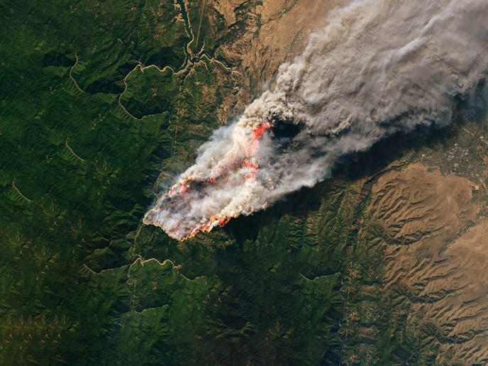
A steady supply of various mineral raw materials is critical for driving growth in key sectors of the European economy. Yet, the mining industry faces persistent challenges: accurately separating ore from waste at the source, avoiding costly mistakes, such as misclassifying or re-handling materials, and consistently monitoring waste materials including tailings and waste rock. Earth observation technologies can transform the mining industry by making operations more efficient, using less energy and reducing environmental impact. These technologies can bridge the gap between broad, coarse satellite data and fine yet slower analyses from laboratories or post-flight studies.
Improving mining with hyperspectral technology
The EU-funded m4mining(opens in new window) project is designed to transform how we map and monitor both active and inactive mining sites by using advanced Earth observation technologies based on hyperspectral imaging(opens in new window). “At its core, m4mining aims to make mining decisions faster, greener and more reliable by bringing hyperspectral sensing and advanced analytics directly to decision-makers at the source,” notes project coordinator Edmond Hansen. Hyperspectral imaging is an advanced imaging technique that captures data across the complete light spectrum for every pixel in an image, revealing valuable information about the properties of the objects being captured. This spectral information can be used to identify and analyse materials, detect their chemical compositions and assess the environmental conditions. To achieve its goals, the consortium is developing innovative software and hardware to integrate high-resolution hyperspectral data from heavy-lift drones with the broader coverage of satellites. These tools are being tested and validated in real-world conditions at mining sites in Cyprus, Greece and Australia.
Turning complex data into actionable 3D mineral maps
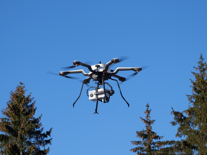
The consortium has developed a highly integrated unmanned aerial vehicle platform (UAV) equipped with a hyperspectral camera, LiDAR, RGB imaging and inertial navigation. This set-up links every pixel of spectral data to a precise 3D model of the scene. The computing system is split between the drone and a nearby ground node, enabling edge processing – part of classification and mapping occur mid-flight, delivering actionable mineral or alteration maps within minutes instead of days. On top of this, the team has built end-to-end processing pipelines with decision-support and visualisation tools, presenting results as intuitive 3D mineral maps rather than raw data. These maps are generated from both drone flights and satellite data. To ensure reliability, the technology is supported by standards, deployment and safety guidelines, simulators for real-time testing and validation campaigns at the three mining sites.
Forging a smarter future for mining operations
“m4mining provides mines with a powerful decision engine that shrinks the loop between ‘scan’ and ‘act’,” highlights Hansen. This enables better grade control to extract high-quality ore, smarter material blending to meet standards and proactive tailing monitoring to tackle environmental concerns. It also supports data-driven re-mining of valuable materials from discarded waste. On a broader scale, the project promotes standardised workflows, data sharing and safety practices for UAV hyperspectral mapping, guided by an industry advisory board. This should help lower adoption barriers across the sector, extending benefits beyond the pilot sites. “The ultimate goal is a more efficient and transparent mining ecosystem, where valuable materials are recovered more completely, environmental risks are addressed early and operations align better with circular-economy principles,” concludes Hansen.