Satellite data strengthens water management capabilities
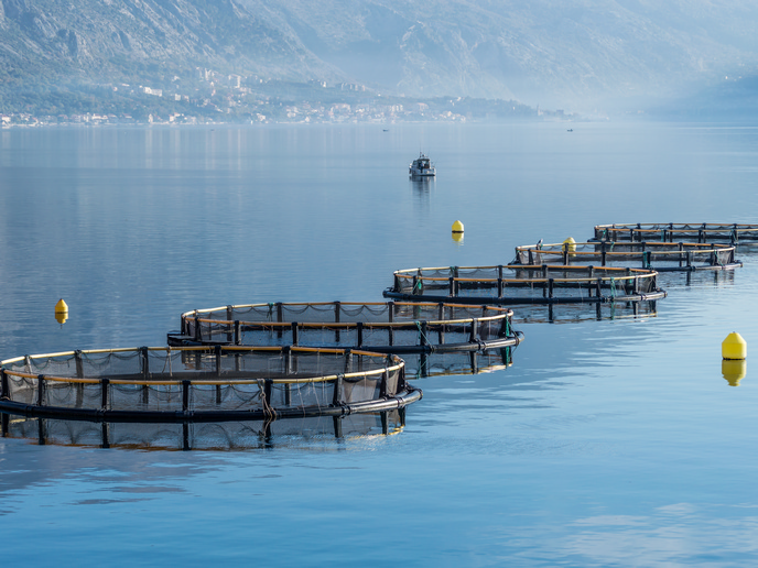
Population growth, changing climate patterns and widespread pollution are putting water resources under pressure. In many regions there is a lack of timely, reliable and actionable data for decision-making on water quality and availability. “Extreme weather events like severe droughts and rainfall have sharply increased over the past two decades, causing massive infrastructure damage,” says SWIM(opens in new window) project member Keenan Lucas, technical project coordinator at Offshore Monitoring(opens in new window) in Cyprus. “Additionally, water bodies are increasingly threatened by harmful algal blooms that cause significant economic losses, particularly to the aquaculture industry.”
Predictive modelling and actionable recommendations
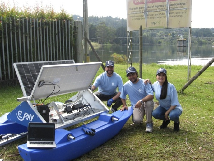
The SWIM project sought to strengthen water management capabilities with an ‘all-in-one’ platform that not only displays data, but provides predictive modelling, real-time alerts and actionable recommendations. To achieve this, a multidisciplinary team from five countries was brought together, combining skills in Earth Observation, internet of things (IoT) hardware, software engineering, hydrology, and local socio-environmental governance. “The project used a data fusion approach, combining broad Copernicus(opens in new window) satellite imagery with precise, real-time ground measurements from floating Water Monitoring (WAMO) IoT sensors,” explains Lucas. “To process this massive amount of data, machine learning was used to actively calibrate satellite readings against the ground truth data.” An artificial intelligence-assisted decision support system (AI-DSS) was integrated to generate automated, actionable alerts. The whole system was then tested in real-world scenarios in Colombia, specifically at the La Fe Reservoir (for water quality and balance) and the Las Palmas watershed (for natural disaster risks). “The team worked directly with local utilities and municipalities to ensure the platform met practical, operational needs,” adds Lucas.
Multi-sensor data fusion approach
This pilot testing demonstrated that the SWIM research concept works in practice. The project’s solar-powered WAMO buoy successfully transmitted live water-quality data directly onto the platform, while American partner Rayner Software’s(opens in new window) Orbiter app leveraged the vast amount of data collected by the Copernicus programme. The project team also showed that machine learning can predict river discharge even in areas with very limited local monitoring. The team believe that utilities, regulators, emergency responders, private companies, insurers and local communities can all benefit from having better, more timely information about what is happening in a water basin. “The real strength of this solution is that it combines technologies that are often kept separate: satellite observation, on-the-ground sensing, machine learning and decision support,” notes Lucas.
Integrating satellite with ground monitoring
Next steps involve moving from a strong prototype to a fully operational platform. This will involve completing validation across the pilot sites, strengthening the integration between satellite and on-the-ground monitoring, and proving that the system’s core modules can work together in real conditions. “We also want to enhance the platform’s emergency response features, improve the user experience for different types of stakeholders, and make it easier to connect SWIM with monitoring systems already used by utilities and public authorities,” says Keenan. “In parallel, we’re developing the commercial roadmap, securing the right funding pathways, and protecting the project’s core innovations so the platform is ready for scale.”