

Space-based applications to keep the roads and rails flowing
While Earth Observation data provides critical, actionable insights for sectors such as agriculture and disaster management, there are many areas where this technology’s full potential remains untapped. The SPATRA(opens in new window) project identified road and rail transport as two key sectors that could benefit further from such satellite-enabled applications. “When we speak about using satellite data for land transport we tend to think about applications that use global navigation satellite systems such as EGNSS(opens in new window),” says SPATRA project coordinator Danijela Ristic-Durrant from OHB Digital Services(opens in new window) in Germany. “Earth Observation data, for example openly accessible Copernicus Sentinel(opens in new window) data, is not used so much. In this project, we wanted to demonstrate situations where such data could bring benefits.”
Monitoring rail temperature fluctuations
The project proposed and developed two use cases, one for road transport, the other for rail. The first use case focused on monitoring and forecasting temperature impacts on rail networks. “Infrastructure managers often use weather forecasts to predict if tracks are likely to get too hot,” explains Ristic-Durrant. “They then issue what are called low-speed orders to train drivers or stop traffic altogether.” This can lead to significant disruptions in rail operations. The SPATRA team developed a system that combines Copernicus thermal satellite data with machine learning to increase data resolution for rail temperature monitoring and rail buckling risk estimation. Field-tested in Serbia, the system demonstrated the potential to enable infrastructure managers to continuously monitor rail temperature fluctuations across the whole network, and to identify track deformation risks earlier, ensuring safe and efficient rail services.
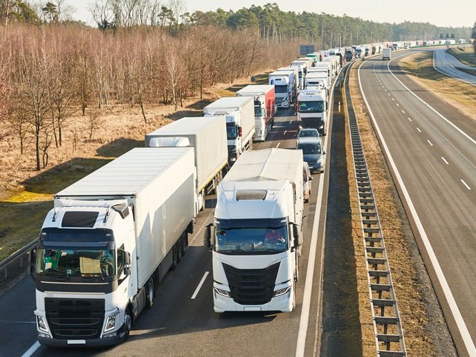
Targeting congestion at border crossings
The second use case focused on targeting congestion and optimising parking facilities at Serbia’s Batrovci border crossing. “The idea was that satellite data could be used by logistics managers to monitor congestion levels at borders and also assess parking slot occupancy,” adds Ristic-Durrant. By harnessing the capabilities of both the European Global Navigation Satellite System and Copernicus satellite systems, combined with drone-based vision and artificial intelligence (AI), logistics managers could plan journeys more efficiently and estimate arrival times more accurately.
Environmentally friendly land transport networks
The SPATRA project has shown how Earth Observation data can be applied in AI-enhanced models to ensure smooth and safe transport. Improving road traffic management and rail infrastructure monitoring will contribute to more efficient and therefore more environmentally friendly land transport networks. “We succeeded in increasing the technology readiness level of these applications,” notes Ristic-Durrant. “As with any system that uses AI models, we now need to gather more data to train the models.” Further improvements and field testing will help to bring the technology closer to market readiness, and also hopefully encourage further investment in satellite-based land transportation solutions.